WIIS
The Weather Image Information System (WIIS) closes
this gap and provides online the following weather information products:
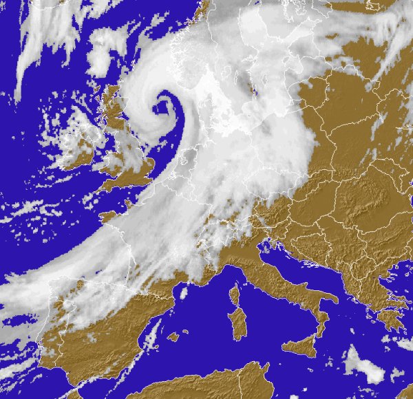
The high-resolution images from METEOSAT and weather
radar images provide an excellent weather overview even before a weather front (storm, rain, snow)
reaches the area of interest. Animations visualise the movement of individual weather cells and so
one can evaluate when to expect the front.
The high-resolution weather radar images provide
detailed information. Optionally these images can be combined with data from weather stations.
Further individual background information like road or power supply line networks can be
integrated. Customer-provided information can also be integrated.
The handling of WIIS is intentionally
organised in buttons and is very straightforward. The buttons are defined by the
administrator. According to requirements they switch between METEOSAT and weather
radar images. Therefore also layman and non-meteorologist can use the software
efficiently.
WIIS automatically triggers alarms when critical
weahter situations occur. The user can individually define critical situations e.g. exceeding of a
certain wind speed, the undershooting of a certain temperature, the occurence of storm fronts or
lightning strokes in certain regions, or the trasgression of a certain amount of the daily rain
rate. Critical situations ca be defined specifically for different regions. If required the system
can also issue an alarm via SMS or email.
This module detects the path of storm and rain
fronts and predicts their further progression. With this feature you can better predict when and
were a front reaches a certain area.
Other prediction data available are high resolution forecast images of Temperature, Snowfall, Wind, Global Radiation and Relative Humidity.
We offer to manage the complete project. We advise
on the weather products that meet your requirements, we help with the conclusion of contracts with
the data supplier, we install the software on your computer, we advise on the setting up for the
required internet connections, we instruct on site all features of the system and configure and
maintain the system according to your specific requirements.
All of these parameters are provided by a server and can be transmitted and displayed on your
personal computer via internet. You can choose the displayed range, the background information and
assign different colours to different data.
Weather overview
Weather details
Easy handling
Alert
Prediction
Project-Management